By Marcus Taylor, based on a talk he gave to the Friends of Lewes on 17 May 2022.
Additional material was added in February 2023.
The Sussex Ouse, one of five UK rivers to bear that name Ouse, is just 48 kilometres long. Of its network of mainly short tributaries spread across the Sussex Weald and Downs, two join the river close together in Lewes: the Winterbourne and the Cockshut. Together these two streams total about 10 kilometres at most in length, and some of the time one of them does not flow at all, yet their impact on Lewes over the centuries has been disproportionate to their size.
The Winterbourne – the clue is in the name – is usually a dry channel for the summer half of the year, and is born in winter, though not inevitably every year. I recall it failed to appear at all for two years together in the late 1980…
The name Cockshut is less obvious. The word, first used in the early Middle Ages, has two meanings, both of them now obsolete: it can refer to twilight or nightfall (a time for birds to take some shuteye, perhaps?), or it can relate to a netting enclosure for catching woodcock: these are large nocturnal wading birds, also known as a snipe. Since this stream flows across the northern edge of the lower Ouse flood plain, known locally as the Brooks, which was once marshy land mostly inundated every winter, this would be ideal territory for these birds, which featured regularly on menus in previous centuries alongside better-known game.
Margaret Thorburn’s brief but illuminating article in Sussex Past & Present for August, 2002 puts forward a third suggestion – that the name may be a derivative of cocker, which at one time meant a conduit or sluice…. Plausible, but I think I’ll go with the second ornithological one.
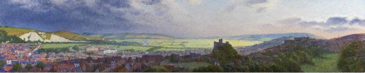
Let us look more closely at the limited geography of these two streams, their role in local history and the impact on Lewesians of what appears at first sight to be a couple of piddling little watercourses.
The Winterbourne Stream
The Winterbourne rises west of Lewes, alongside the A27 road, just to the west of the Newmarket Inn. Its spring is not always evident and can be elusive, but under usual conditions, somewhere in this ditch shown on the right is where it is first to be seen.

Newmarket Inn (left), the Winterbourne’s spring (right) (click to enlarge)
Under the right conditions, however, when the water table in the chalk of the downs is high enough, its source is very obvious, indeed dramatic.
In the big floods of 1960 water poured out of the hillside at the spring-line, flooding the Brighton Road, (which was a much smaller, single carriageway road in those days) as well as Littledown Farm and Villas and also Barrack Cottage, which had to be demolished afterwards. (I am grateful to Colin Brown and Charles Keen for letting me share these photographs.)

1960 flood on Brighton Road

1960 flooding at Littledown Farm and Villas, and Barrack Cottage (click to enlarge)
The Winterbourne is seen here (below, left) in a recent winter streaming across a grassy field only a few hundred metres from its source.

Winterbourne streaming in winter (left), and near Glebe Close (right)
The creation of the Lewes by-pass in the mid-1970s meant that the stream’s course had to be ordered and redirected. It disappeared underground, coming out in a deep channel close to the Houndean Allotments, and is seen again close to and on the northern side of the railway line close to Glebe Close: its first close proximity to housing (above right).
Opposite the foot of Delaware Road it runs over a ramp where the Environment Agency has a measuring station.

Winterbourne at the foot of Delaware Road – in winter (left), and in August (right)
(click to enlarge)
It then runs alongside Winterbourne Lane. Look at just how much vegetation has grown in the stream bed in the months since it became dry. This can pose serious problems as flow resumes in the autumn.

Winterbourne alongside Winterbourne Lane – in January (left), and in August (right) (click to enlarge)
The Winterbourne then crosses under Bell Lane.
Over the years it has carved a clear path for itself – a shallow valley between the old town on the hill and the ridge along which Southover High Street runs.
Sections of it is now in culverts, and are only intermittently visible. One is seen here from St Pancras Road where there is also a metal grille – one of several designed to trap larger debris, which the Environment Agency can clear out when needed.

Winterbourne culvert at St Pancras Road (left), and grille (right) (click to enlarge)
The stream passes largely unseen behind the houses on the south side of Grange Road, then resurfaces briefly by the Western Road primary school car park opposite Southover Grange.
Whether dry or wet, its course is a feature of the Grange Gardens before it disappears at the eastern end of its channelled run in a culvert underneath the railway station.

Winterbourne at school car park, and into Grange Gardens, a feature whether dry, or flowing
(click to enlarge)
It emerges to make its way across what is now the Railway Land, much of which had been goods sidings in the 1960s, but by 2000 was being managed as a Wildlife and Nature Reserve.
The Winterbourne finally reaches the Ouse through an outlet close to where the Linklater Pavilion stands.

Winterbourne in the Railway Land (left), and entering the Ouse near the Linklater Pavilion (right) (click to enlarge)
The Cockshut Stream
The Cockshut is the most northerly of a network of drainage ditches across the Brooks, but its source is initially hard to pin down; on OS maps it first appears clearly near the Kingston Road, the C7, to the west of the Stanley Turner sports ground, but its springline and headwaters are nearer Kingston and Wellgreen Lane in particular; it also collects water from the land around Spring Barn farm and the slopes down from Swanborough.
 I went looking on foot and about 50 metres off the Kingston Road, under a decent-sized hawthorn tree I found what looked like a spring, with just a trickle of moving water even in August (left).
Within a few metres it has become a reed-filled ditch (below left).
It is then joined by water from drainage ditches across the northern part of the Brooks: this can be quite a substantial volume in winter, as shown by this photo by my friend Paul Mockford taken in February, 2022 (below right).

Cockshut ditch near source (left), Cockshut in Winter (right) (click to enlarge)
This should be no surprise: in the early 1970s I recall talking with a farmer at Swanborough, who said that his relatives had told him that within living memory the whole of the lower Ouse valley flooded for much of the winter pretty much every year, until drainage channels were dug and linked to a pumping station near Southease bridge.
The Cockshut’s course was also directed under the by-pass embankment and first makes a clear appearance as a watercourse on the northern side of the service road that links Cockshut Lane to Ham Lane, alongside the Southdown Club.
These days there is little appearance of flow here. Occasional clearance work by the Environment Agency reveals it to be a clear channel some 5 or 6 metres wide, as shown in this photograph (left) taken in February 2013, but it is very overgrown at present, as can be seen from the photo near Ham Lane, taken in the Spring of 2022 (right).

Cockshut after clearance work (left), overgrown, and near Ham Lane, Spring 2022 (click to enlarge)
Lewes District Council is about to start a project to divert part of the course of the upper Cockshut into a new channel, avoiding the invasive species of plants (mainly Parrot Feather) that are choking it, and creating a wetland habitat in the northern Brooks that will both help with flood management and create more diversity of wildlife. This is really good news!
The Cockshut was crucial in enabling the construction of Lewes Priory, starting around 1080, by providing at that time access at high tide from the river Ouse right alongside the chosen site.
 Following the Norman Conquest, the Rape of Lewes (a traditional administrative division of the county) was given by King William I to his trusted friend William de Warenne. Lewes is a gap town in the South Downs and provided unrivalled views, but relatively flat land is at a premium. Whilst William could see the military and strategic possibilities in a hilltop castle, his wife Gundrada spotted the shelf of almost level land at the top edge of the flood plain as a potential site for her intended monastic foundation. It was to be the first Cluniac Priory in England.
This is amply illustrated in this artist’s reconstruction of medieval Lewes showing the Cockshut in the foreground, then a tidal creek, allowing shallow draught vessels, like these shown in the Bayeux Tapestry, to cross the Channel and come in bringing fine Caen stone and much else from Normandy.
Cockshut in medieval Lewes, artist’s reconstruction, Vessels from Bayeux Tapestry
(click to enlarge)
In front of the steep hill up to the town and castle, there is what appears to be a glimpse of a vessel on the Winterbourne, which came close to the Water Gate – is this artistic licence, or might it once have been less seasonal and even occasionally navigable?
As the Priory grew, the Cockshut stream fed its meadows, fish ponds and mill and received out-flow from its advanced drainage system, making a vital contribution to its functioning. In this regard Lewes echoed the systems found at its mother house in Cluny and at Canterbury.

Enlargement shows vessel on Winterbourne (left), Cockshut feeding Priory fishponds (right)
(click to enlarge)
In the seventeenth century water from the Cockshut fed into Lewes’ first pumped water supply and early in the twentieth century sewage works were built alongside it, utilising its water, off Ham Lane as it nears the River Ouse.
There was once a lift bridge over the Cockshut at the point where Ham Lane turns left and on to the present day Household Waste and Recycling Facility.
Flooding
Amongst other things, the Winterbourne stream helped give a name to Lewes’ southern suburb, which from the town lay to the south, over the stream – hence Southover.
To understand why the stream should likewise bear a very literal name – born in Winter – requires a look at the structure of the local area’s underlying geology. Layers of chalk from different periods form an aquifer – water-bearing rock – over a hundred metres deep. Rainfall percolates through this at widely varying rates, depending on its density and structural weaknesses, eventually reaching the surface in a line of springs along the foot of slopes. If, through abstraction for use for agriculture or drinking water, or through drought, the water level in the chalk falls below this line, the streams stop flowing.
Once the level of saturation in the chalk exceeds that level, the streams will flow for a time, even when there is no further rainfall. Once the chalk is fully saturated, heavy rain cannot be absorbed and will run straight off, creating serious and sudden flooding. We have already seen the impact of the 1960 flood on the area near the Newmarket Inn very near the source of the Winterbourne.
There are records of parts of Lewes being affected in this way on at least six occasions in the past 120 years, with major floods in 1960 and in October 2000, when a typical month’s rain fell on the Ouse’s catchment in just two days and met the incoming high tide.
The Winterbourne has influenced how its valley has been settled, was once a seasonal barrier to movement south from the town and occasionally has brought serious localised flooding.
I am indebted to Alan Pilfold for letting me scan his photographs of the impact of flooding on Southover.
The channel alongside Winterbourne Lane looks both deep and wide when empty, but this rather blurry 1960 photograph shows the stream in spate, spilling out across the road (left), and turning the Bell Lane recreation ground into a lake (right).

Flood at Winterbourne Lane (left), and Bell Lane recreation ground, 1960 (left)
(click to enlarge)
From this point on the stream is channelled for much of its remaining route, though the walls and culverts vary in cross-section, creating potential over-spill points.
St Pancras Road was flooded, and those in the houses and shop, later replaced by blocks of flats, took desperate measures.

Flood at St Pancras Road (left), escaping from 1960 St Pancras Road flooding (right)
(click to enlarge)
Similar measures had been taken years earlier – this is a photo of flooding at St Pancras Road from around WWI. Older men and boys feature, but few of those of age for military service (below left).
Along in the Course in 1960 the water came up to the window-sills of the terraced houses – to a depth of about two feet (right).

St Pancras Road flood, World War 1 (left), Flooding at The Course, 1960 (right)
(click to enlarge)
This grainy newspaper photo below shows volunteers, possibly WRVS ladies, helping residents cope afterwards (below left).
The Girls’ Grammar School in Potter’s Lane was flooded (right), and had to be closed for months, forcing the girls to share premises with the boys on the Mountfield Road site, to general consternation… Might some of you have a memory of this?

Volunteers helping residents after 1960 Lewes flood (left), Girls’ Grammar School in Potters Lane, flooded 1960 (right) (click to enlarge)
Another newspaper photo here shows a mobile pumping engine at work at the school (left), but the playing fields took their time to drain (right).

Pumping out flooded school, Potters Lane, 1960 (left), Flooded school playing field, 1960 (right) (click to enlarge)
St James’ Street was mainly water, as were Southover High Street and Eastport Lane:

St James’ Street (left), Southover High Street and Eastport Lane (right) flooded in 1960
(click to enlarge)
Garden Street, where the boundary wall of the Grange Gardens had been breached (left), and the Cattle Market (right):

Garden Street flooded, with breach of Grange Garden wall (left), Cattle Market flooded, 1960 (right) (click to enlarge)
Amidst these images of flooding, it is important to remember that over the years the channel through the Grange Gardens, now fenced off for safety, has more often offered a paddle or a totally dry concrete bed.
Similar flooding, though not as bad, occurred in the mid-1970s when the culvert under the railway station blocked and the lower floors of houses on the northern side of Dorset Road were flooded.
This was repeated in 2000, and the owners of the new houses in Tanners Brook, built on the site of the old Cattle Market found the street’s name a bit too accurate!
The Lewes railway station was closed by Winterbourne flood waters in both 1960 and 2000:

Garden Street flooded in 2000 (left), also Lewes railway station (right) (click to enlarge)

Lewes railway station flooded, 1960 (click to enlarge)
The last of these photos was posed for a journalist!
Long on history, if short in length, these two small tributaries have had great influence on Lewes.
The Winterbourne, and the Cockshut streams can be traced, partially, on Google maps.

Click on map to enlarge
